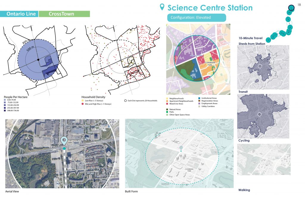
A guide to reading the Ontario Line station profiles, including density, land use policy, aerial views, 10-minute travel sheds, and built form context.
The Ontario Line – Station Profiles & Growth Opportunities
The Ontario Line represents a great opportunity for the City of Toronto. It will offer significant improvements to transit, liveability as well as many economic benefits to the region. The Line will improve travel experiences, increase access to employment, reduce travel time, while encouraging greater transit-oriented development and communities.
This specific Study provided profiles of the 12 new stations being developed as part of the Ontario Line, including snapshots of each area’s density, existing zoning, travel sheds, aerial views, configurations, and built form. This easy-to-digest information should enable those in the planning and development community to make informed decisions about how smart growth can take place along the Ontario Line.
Understanding this proposed new transit system will lead not only to smart investments for development, but to more livable and desirable communities for Toronto’s growing and diverse population as well.
The Don Valley (formerly Science Centre) Station profile illustrates existing density, land use, transit access, aerial conditions, and built form within the surrounding station area.
Download the Ontario Line Station Profiles to review station-by-station data on density, land use, travel sheds, and built form.
We use cookies to ensure that we give you the best experience on our website. If you continue to use this site we will assume that you are happy with it.